
Geographic Data Service
At a glance
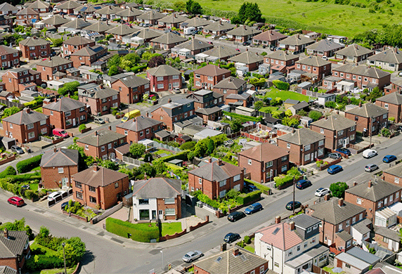
The UK’s leading source of linked and georeferenced smart data
Maps using information from: demographics, retail, financial and transport sources
Research-ready datasets covering the UK for social scientists, health researchers and policymakers
Study populations at risk, regional disparities and equality of opportunity
About
Connecting different types of data through geography to study important social issues, including vulnerable populations, regional inequalities, and access to opportunities.
The Geographic Data Service (GeoDS) is the UK’s leading source of linked and georeferenced smart data.
Geographic integration reveals complex patterns through spatial analysis. Applying these techniques scientifically and ethically to smart data generates new insights into the differing circumstances of populations, guiding targeted strategies to enhance economic and environmental outcomes.
Read GeoDS director Professor Paul Longley’s blog on Unlocking the power of geographic data.
Data focus
- Linked and georeferenced national smart data integrating demographics, retail, image, financial, and transport sources
- Comprehensive data partnerships with companies and organisations across sectors
- Combined smart data and statistical sources for enhanced geographic insights
- Detailed mapping of socioeconomic patterns across different UK regions
What’s coming?
- Nationwide smart data coverage in standardised, research-ready formats
- User-friendly data visualisation and mapping platform for researchers and policymakers
- Advanced analytics focusing on at-risk populations and regional disparities
- Masters Dissertation Scheme connecting students with industry partners
Population insights for better planning
The Greater London Authority (GLA) partnered with GeoDS to build a classification system called the London Output Area Classification (LOAC). It captures the distinctive population characteristics of London’s residents.
LOAC has helped the Authority to pinpoint areas that were rapidly becoming more densely populated, allowing it to strategically plan for public services such as the number of school places needed.
The team
The Geographic Data Service is led by Professor Paul Longley from UCL and Professor Alex Singleton from the University of Liverpool. It includes experts from the Saïd Business School at the University of Oxford and the University of Edinburgh.


Contact GeoDS
Discover more about the Geographic Data Service at the GeoDS website. If you would like to contact the team, please email them at geods@ucl.ac.uk.